Berat Map: A Practical Orientation To Albania's City Of A Thousand Windows
Berat in central Albania is a UNESCO World Heritage Ottoman hill town on the Osum River, and almost everything a visitor needs sits within a compact stretch you can cross on foot in half an hour.
Short answer
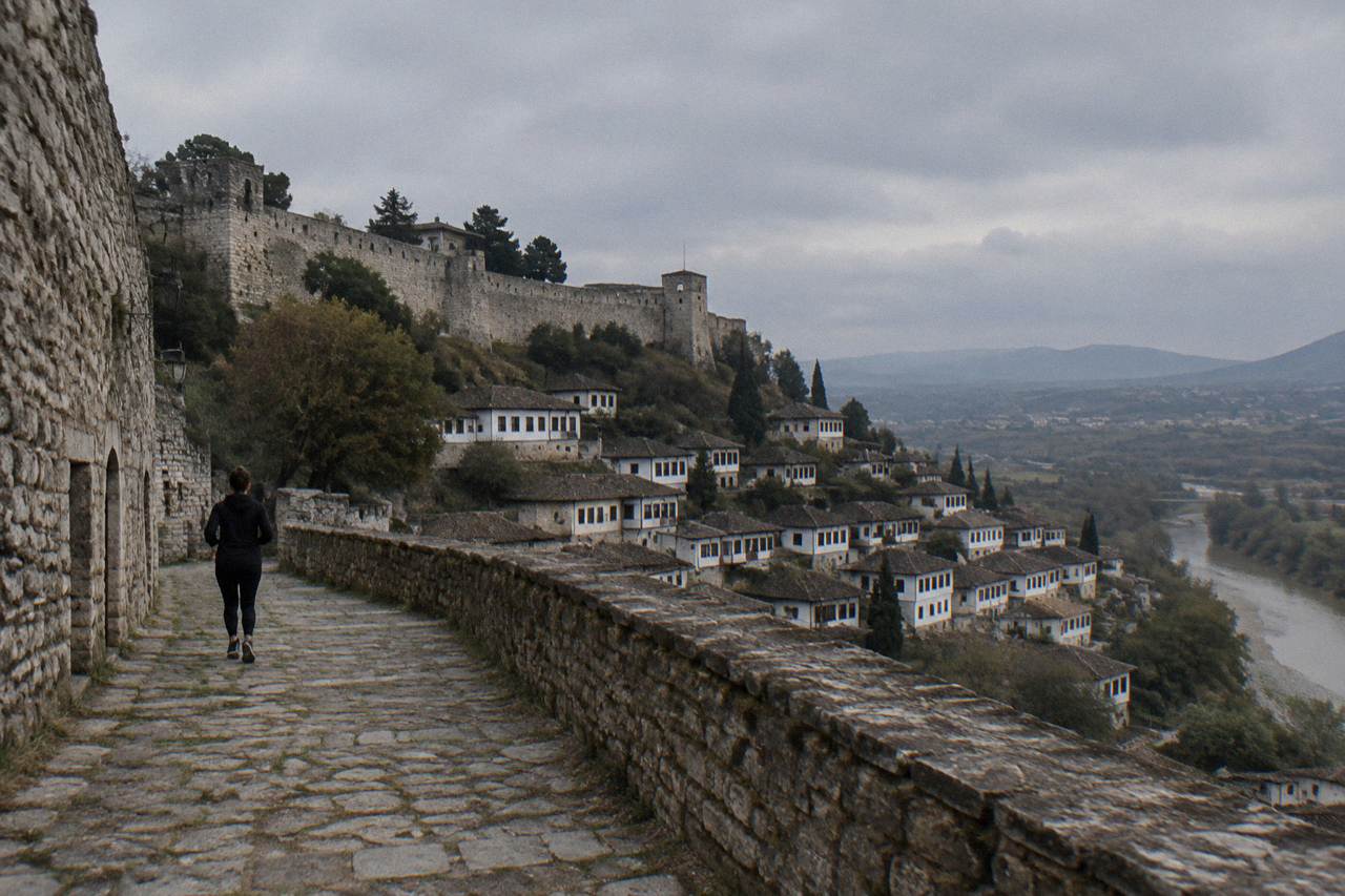
Berat lies in central Albania on the Osum River, roughly 2.5 hours by bus from Tirana, with a resident population of 62,232. The castle quarter of Kala rises above the Ottoman Mangalem district, Gorica faces it across the river, and the historic core is compact enough to explore entirely on foot.
Berat, in central Albania, is a UNESCO World Heritage Ottoman-era hill town built on and around a castle-crowned spur above the Osum River, and once you can place its handful of districts on a map, the whole town becomes effortless to read. The historic core is small. A resident population of 62,232 lives across the wider municipality, but the part visitors come for, the castle, the Mangalem quarter, the Gorica quarter and the river crossing between them, packs into a stretch you can walk end to end without hurrying. This guide lays the town out district by district, explains how the hills and the river force the layout, and shows where transport, food, sleep and day trips sit relative to everything else.
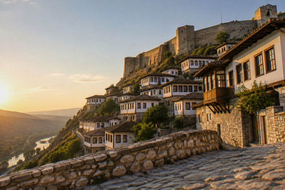
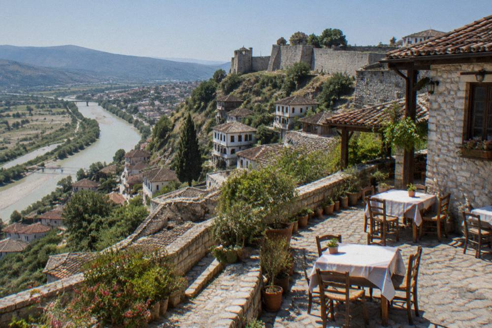
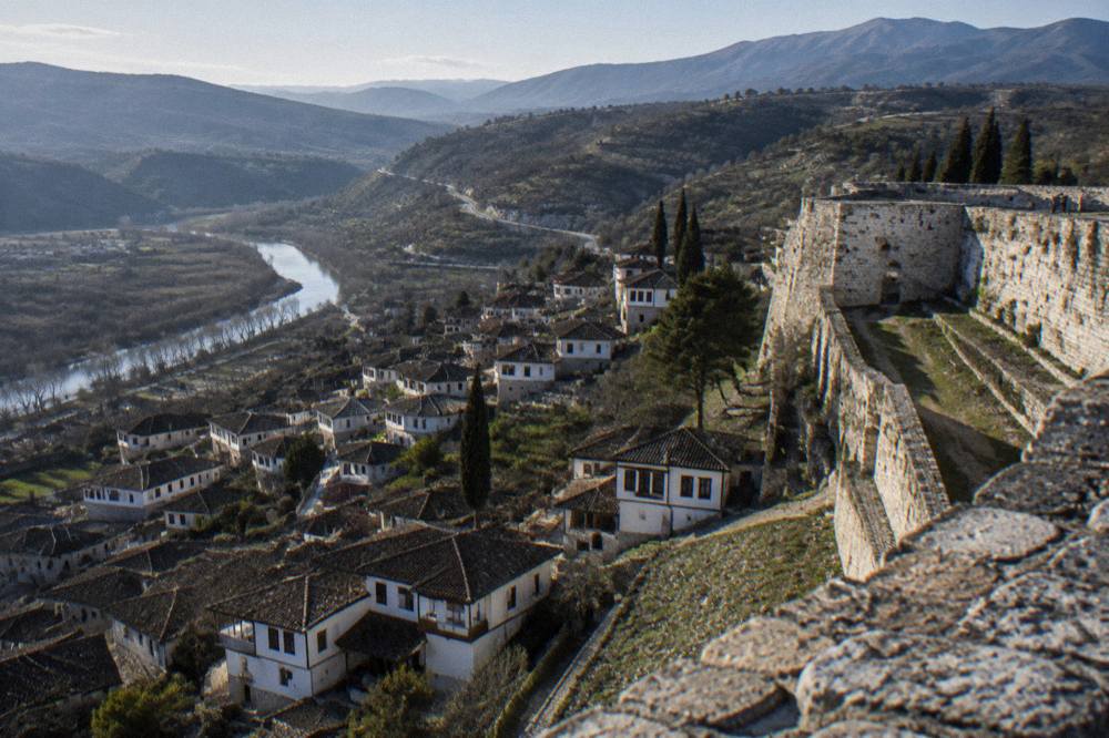
Think of Berat as three vertical layers. The Kala, the castle quarter, occupies the hilltop, with walls and towers looking down on everything below. Mangalem spills down the eastern slope beneath it, the famous stack of white houses whose many windows give the town its nickname, the City of a Thousand Windows. Across the Gorica Bridge, on the opposite bank of the Osum, the Gorica quarter mirrors Mangalem with its own stone-and-wood houses. Below both, along the river, runs the modern town with its promenade and the boulevard locals use for evening walks. Once those pieces are fixed in your head, the rest of this Berat Travel Guide article, and every paper map you pick up on arrival, will make immediate sense.
Where Is Berat On The Map Of Albania?
Berat sits in central Albania, inland, on the Osum River, roughly 2.5 hours by bus south of the capital Tirana, in a region whose high ground is dominated by Mount Tomorr at 2,416 metres. It is not a coastal town and it is not the capital; Albania's capital is Tirana. The nearest coast lies well to the west, reached by onward transport covered in our page on getting from Berat to the coast and beyond. Berat is the center of its own municipality and lies in the Berat and Skrapar region, the same region that holds Tomorr and the Osum canyons, which is why so many canyon and mountain day trips start from here.
The town's World Heritage status is shared, and this is a point a good map makes obvious. The UNESCO property is called the Historic Centres of Berat and Gjirokastra: Gjirokastër was inscribed in 2005 and Berat was added in 2008 as an extension of that listing. UNESCO describes Berat as a rare example of a well-preserved Ottoman town, and the citation notes that it bears the imprint of a more independent lifestyle, linked to its handicraft and merchant functions. The protected property covers 58.9 hectares across both towns, with a buffer zone of 136.2 hectares. In practice, that inscription is what draws most visitors, and it is why the old quarters, not the modern blocks, are the part of the map worth studying. Our longer page on Berat's UNESCO heritage listing unpacks the inscription; this one stays with the geography.
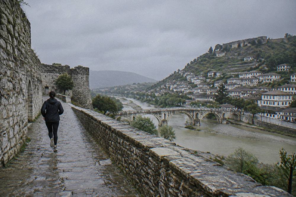
The river is the organizing feature. The Osum flows through the middle of town, dividing Mangalem and the castle hill from Gorica, and every route between the two old quarters funnels across the Gorica Bridge. The newer part of town spreads along the banks and up the valley, with the boulevard and the riverside promenade acting as the connective tissue between old and new. A visitor arriving by bus lands on the outskirts of town, a walk or short taxi ride from Mangalem, a point covered in detail in our Berat bus station guide. From there, the map compresses: uphill to the castle, downhill to the river, across the bridge to Gorica, and back.
What Are The Main Areas Of Berat On A Map?
A map of Berat divides into five usable areas: the Kala or castle quarter on the hilltop, Mangalem on the eastern slope below it, Gorica across the bridge on the far bank, the river corridor with the Gorica Bridge and the promenade between them, and the new town around Bulevardi Republika. Each has a distinct character and a distinct function for a visitor, and each is small enough that you will learn them by walking, not by studying. The castle is the anchor: it is a lived-in quarter, not a ruin, with guesthouses operating inside the walls, and its walls carry 24 defensive towers. About 42 churches once stood inside the fortress; roughly eight are preserved today.
| Area | Position on the map | What it is known for |
|---|---|---|
| Kala (castle quarter) | Hilltop, above Mangalem | Fortified living quarter with 24 towers, Onufri Museum, about 8 preserved churches of some 42 built |
| Mangalem | Eastern slope below the castle | Stacked white Ottoman houses, the City of a Thousand Windows |
| Gorica | Opposite bank, across the Gorica Bridge | Historic quarter mirroring Mangalem, quieter streets |
| River corridor | Between the two quarters | Gorica Bridge, riverside promenade along the Osum |
| New town | Along and behind the boulevard | Bulevardi Republika, shops, cafes, everyday Berat |
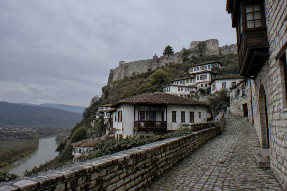
Mangalem and Gorica are the photogenic halves, and they genuinely are halves: the bridge between them is the single most walked link in town. Mangalem climbs in tiers, so the higher you go the better the view back over the river, which is why photographers cluster at its upper lanes at dusk, a habit covered in our Berat photography spots page. Gorica is the calmer bank. Fewer visitors cross, the lanes are shaded, and the walk up through it delivers one of the best views of Mangalem's full hillside from across the water. The new town is where practical Berat lives: banks, pharmacies, the everyday cafes, and the promenade where the evening stroll happens.
If you are planning a first visit and want the structure of the town explained while you walk it, a guided option saves you the map-studying entirely. The selection below pairs a full-day guided tour with two alternatives in different formats and price ranges.
For most visitors the areas resolve into a simple routine: mornings in the castle, afternoons wandering whichever bank you have not done yet, evenings on the promenade. Where you sleep determines which direction you face each morning, and our where to stay in Berat page maps the guesthouse options quarter by quarter, including the rare ones inside the castle walls and the family-run places in Mangalem and Gorica.
How Do The Sights Of The Old Town Sit Relative To Each Other?
The sights of Berat's old core stack in a tight vertical sequence: the castle and the Onufri Museum at the top, Mangalem's mosques and lanes on the slope below, the Gorica Bridge and the river at the base, and Gorica's own lanes on the far bank, all within a walkable cluster. The Onufri Iconographic Museum sits inside the castle itself, reachable on foot from Mangalem, and it holds the iconographic work for which the town is artistically famous. The Ethnographic Museum, reopened 30 May 2026 after a three-year restoration and now displaying around 1,300 objects, sits down in the old quarters. Between them, the lanes of Mangalem hold the King Mosque, the Lead Mosque and the Halveti Tekke, each an easy detour on the walk up or down.
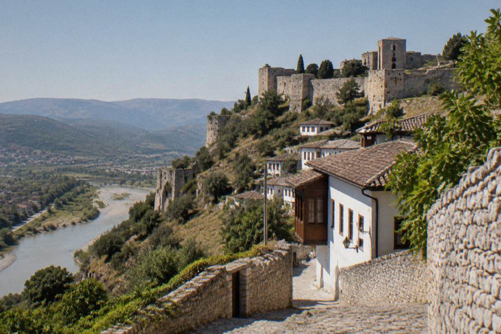
The vertical arrangement matters because of the climb. The walk up to the castle is the single steepest stretch in town, and how long it takes from the bottom is a question we answer in full in our article on how long the walk up to Berat Castle takes. Everything else is flat by comparison. The promenade along the Osum is level, the lanes through Gorica are gentle, and the boulevard in the new town is a flat evening stroll. Visitors with mobility constraints will find the castle the hard part and the river corridor the easy part, a mapping we do in detail on the Berat accessibility page.
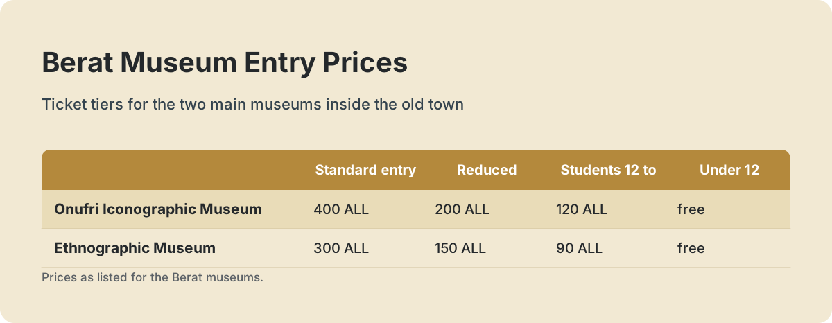
Museum tickets and hours are fixed, official figures, and they belong on any map-based planning table because they decide where you go on which day.
| Museum | Standard entry | Reduced, students and children | Summer hours (1 May to 30 Sep) | Winter hours (1 Nov to 30 Apr) |
|---|---|---|---|---|
| Onufri Iconographic Museum | 400 ALL | Reduced 200 ALL; ages 12 to 18 and students 120 ALL; children under 12 free | Daily 9:00 to 18:00 | Tue to Sat 9:00 to 16:00, Sun 10:00 to 15:00 |
| Ethnographic Museum | 300 ALL | Reduced 150 ALL; ages 12 to 18 and students 90 ALL; children under 12 free | Daily 9:00 to 18:00 | Tue to Sat 9:00 to 16:00, Sun 10:00 to 15:00 |
An audio guide at the Onufri Museum costs 500 ALL, and the museums keep free entry days each year: 18 April, 18 May, 21 May and 29 September for everyone, and 28 and 29 November for Albanian citizens only. Since November 2025, tickets for cultural sites including the Berat museums have also been available online through the national e-Albania ticketing system. If a guided walk through this stacked layout appeals, the premium walking tour below is the format most first-time visitors choose.
The layout rewards one deliberate choice: do the castle early, before the day warms up and while the lanes are quiet, then descend through Mangalem and finish flat along the river. Summer heat in Berat can top 40 °C, and the castle hill has little shade, so the order of operations is not a stylistic preference but a comfort decision.
How Do You Get To Berat And Around Once You Arrive?
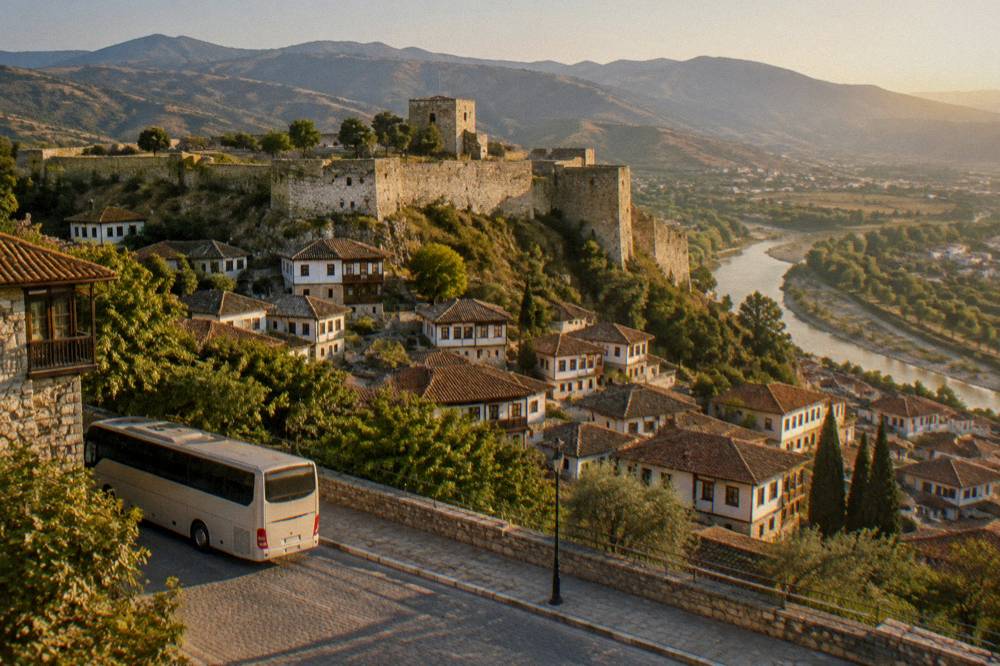
Berat is reached by road: buses and furgons run from Tirana's South-North terminal, Terminali Jug-Veri, taking about 2.5 hours, with departures roughly hourly from early morning to late afternoon, paid in cash; there is no direct bus from Tirana airport and no passenger train to Berat at all. The airport route requires a change: land at Tirana International Airport Nënë Tereza, reach the South-North terminal in Tirana, then take a Berat-bound bus, a sequence mapped step by step in our Tirana airport to Berat page. The fare on the Tirana to Berat run is a few hundred lek in cash, so small notes are worth carrying.
Rail is the one option to strike off your map. No passenger train reaches Berat, and the Tirana to Durrës line with its airport link is under reconstruction with a target of end-2027. Anyone imagining a rail approach to Berat is planning for a future visit. The full bus and furgon picture, including where the vehicles actually leave from in Tirana, sits in our Tirana to Berat transport guide.
| Leg | What the schedule looks like | Practical notes |
|---|---|---|
| Tirana to Berat | Buses and furgons from Terminali Jug-Veri, about 2.5 hours, roughly hourly from early morning to late afternoon | Fare paid in cash, a few hundred lek; no need to commit to a single operator |
| Tirana airport to Berat | No direct service; transfer via the South-North terminal in Tirana | Budget the connection time when booking flights |
| Train to Berat | No passenger service | Line reconstruction targets end-2027 |
| Around town | On foot between all old quarters | Castle vehicle access is being restricted; park below and walk up |
Inside town you walk. The distances that look meaningful on a tourist map are, on the ground, fifteen-minute strolls, and the one steep section is the castle hill. Driving is possible but increasingly awkward in the historic core: car access into the castle quarter is being restricted, so plan to park below and walk up. Our driving and parking in Berat page covers where that leaves a rental car. A new 290-metre EU-funded bridge over the Osum also now connects the Bilçë side to Berat, diverting through-traffic away from the historic center, which quietly improves the walkability of the old core.
Arriving from the coast changes the calculus. Durrës, Golem and the seaside towns sit west of Berat, and a full-day tour with an English-speaking guide from Durrës handles the transfer, the castle and the old quarters in one organized day: see the full-day tour from Durrës with an English-speaking guide and Check availability if that matches your route.
For everyone else, the honest summary is that Berat is a town where the bus timetable matters once, on arrival day, and never again.
What Sits On Each Side Of The Osum River In Berat?
The Osum River splits Berat into two historic halves: Mangalem and the castle on the east bank, Gorica on the west bank, joined by the Gorica Bridge, with a level riverside promenade running along the water between them. The bridge is the town's fixed crossing point and the natural place to orient yourself. Stand on it and the whole map reveals itself, the castle directly above you on one side, Gorica's lanes climbing gently on the other, the promenade stretching level in both directions. The quarter names are worth keeping straight, because hotels, restaurants and directions all use them: Mangalem for the postcard hillside, Gorica for the quieter mirror image.
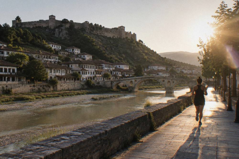
Gorica rewards the crossing. It carries the same protected status as Mangalem, and Albania's January 2026 state-of-conservation report to UNESCO lists completed restoration projects there, including the Gorica quarter historic urban landscape, a castle trail, and parking works near the Old Gorica Bridge, alongside completed works in the Mangalem quarter. In plain terms, both banks have been the object of sustained conservation investment, and it shows in the condition of the lanes. Gorica's guesthouses tend to be slightly quieter than Mangalem's, a distinction we map on the Berat hostels and guesthouses page for budget travelers.
The river also frames the town's best evening walk. The promenade along the Osum, together with Bulevardi Republika in the new town, is where Berat takes its evening stroll, and the two together form a loop you can walk in well under an hour while picking dinner. Food mapping is simple here: the best-known traditional restaurants cluster in and around Mangalem and Gorica, with the new town holding the everyday options, and our where to eat in Berat page plots the names. The small-group castle and old town tour below is the format that covers both banks with a guide, for visitors who prefer the narration version of the same walk.
One mapping rule saves confusion: addresses and directions in Berat are given by quarter first and street second. When a guesthouse says it is in the castle, it means inside the walls at the top of the hill; when it says Gorica, expect to cross the bridge.
Where Do You Eat, Sleep And Shop On The Berat Map?
Eating, sleeping and shopping in Berat map onto the same small geography: guesthouses cluster in Mangalem, Gorica and inside the castle walls, the best-known traditional restaurants sit in and between those two quarters, and everyday shopping and services concentrate in the new town along the boulevard. None of it is far from anything else. A bed in the castle puts you at the top of the map, a ten-minute walk above the river; a bed in Gorica puts you on the quiet bank, a bridge-crossing from the castle path; a bed in Mangalem puts you in the middle of the postcard.
Food geography deserves its own sentence or two. The dishes Berat is known for, qifqi, tavë kosi, japrak, appear on menus across both old quarters, and a cooking class is the way many visitors turn the map into a meal, since several operate out of family homes in the old lanes. Slow Food has a community headquartered in Berat that works on preserving exactly these traditional recipes, which is why local cooking classes lean heavily on local and organic ingredients. For planning costs, a cheap restaurant meal is inexpensive, a mid-range dinner for two is a modest sum, a cappuccino is cheap by European standards, and a shot of raki about two euro, figures we put in context on the Berat costs page.
Shopping follows the same split. The old quarters hold the souvenir-scale shops, the raki and wine sellers, and the small artisans, while the new town holds pharmacies, banks and the everyday purchases; our shopping in Berat page details what is actually worth buying, and our what to eat in Berat page does the same for the table. The one purchase that ties directly to the map is wine: the Berat region's wineries, working with native grapes like Shesh i Zi, Shesh i Bardhë, Vlosh and the local white Puls, sit in the surrounding countryside rather than the town, which is why they appear on the day-trip layer of the map rather than the old-town layer.
Money is the last practical overlay. The currency is the Albanian lek, at roughly 92 lek to the euro and about 80 lek to the US dollar by the Bank of Albania's official rate, and the old town runs largely on cash, with cards accepted at some hotels and larger spots; the details sit on our money and currency in Albania page.
Which Day Trips Radiate Out From Berat On The Map?
The day trips around Berat run in two directions: east and south toward the mountain and canyon country of Tomorr and the Osum canyons near Çorovodë in Skrapar, and south toward Gjirokastër, Berat's UNESCO twin town, with wineries scattered through the countryside in between. The mountain layer is the big one. Mount Tomorr, whose highest point Çuka e Partizanit stands at 2,416 metres, lies in the Berat and Skrapar region inside Tomorr Mountain National Park, and a road project from Berat toward Ballaban was nearing completion as of September 2026, improving that approach. The Osum canyons near Çorovodë are protected as a natural monument, with rafting in the spring snowmelt and tubing in the warmer months, and there is no entrance fee to view the canyon from the rim.
| Destination | Where it sits relative to Berat | What kind of trip it makes |
|---|---|---|
| Osum canyons | Near Çorovodë, in the Skrapar part of the region | Rafting in spring, tubing in summer, rim viewpoints with no entrance fee |
| Bogove waterfall | In Tomorr Mountain National Park country, near Bogovë village | Short forest walk to the falls |
| Mount Tomorr | Highest point 2,416 m, in the Berat and Skrapar region | Mountain day trip, national park |
| Berat-region wineries | Countryside villages around Berat | Wine tasting and vineyard lunches |
| Gjirokastër | South, the other half of the shared UNESCO listing | Full day trip; see our Berat to Gjirokastër route |
The winery layer deserves its own note on any map, because it is the trip that most often gets squeezed out. The Berat region's wineries, including family operations working with Shesh i Bardhë, Shesh i Zi, Vlosh and Puls, sit a drive out of town, and a guided winery tour with transfers is the format that makes them reachable without a rental car. The one below is the region's most-booked version of exactly that.
Hikers should mark Tomorr and the waterfall country firmly: our hiking around Berat page and the dedicated Osumi Canyon guide and Bogove waterfall pages carry the route detail, including the seasonal split between rafting months and tubing months. In late August, the annual Bektashi pilgrimage to the tomb of Abaz Ali on Tomorr draws huge crowds and police traffic restrictions around the Kulmak Tekke, which in 2026 ran from 18 to 25 August; anyone mapping a late-August mountain trip should plan around it.
What Practical Facts Belong On Your Own Berat Map?
The practical layer of a Berat map is short: the currency is the Albanian lek, the general emergency number 112 works from any phone alongside ambulance 127, fire 128 and police 129, US citizens may stay visa-free for up to a year while UK and EU citizens get 90 days in any 180, and Albania is neither an EU member nor part of the Schengen area. The visa point matters for route planning, because time spent in Albania does not count toward a Schengen 90/180 allowance, and the country's EU accession negotiations, with the first chapters provisionally closed in July 2026, have not changed that yet.
Safety is a question worth one line on the map rather than a page: the UK foreign office advises against no travel to any part of Albania, and the US State Department rates the country Level 2, exercise increased caution, on grounds of ordinary crime rather than any threat aimed at visitors. The detail, including the emergency numbers and the tap-water question, sits on our is Berat safe page. Seasonality is the other overlay: summers are hot and dry, with heat that can top 40 °C, and winters are wetter, and since no official station normals are published for Berat we describe that pattern qualitatively rather than in tables; our Berat weather page carries the planning guidance.
| Practical item | The figure to note |
|---|---|
| Currency | Albanian lek (ALL); roughly 92 lek to the euro, about 80 lek to the US dollar |
| General emergency number | 112, works from any phone |
| Ambulance, fire, police | 127, 128, 129 |
| US citizens | Visa-free stay up to one year |
| UK and EU citizens | Visa-free 90 days in any 180-day period |
| Tirana to Berat bus | About 2.5 hours from Terminali Jug-Veri, fare a few hundred lek in cash |
Round the map out with the free layer: the castle grounds, the Gorica Bridge, the promenade and the lanes of both quarters cost nothing to wander, and the museum free days listed above can zero out the only compulsory fees; our free things to do in Berat page maps that version of the town. Between an orientation walk, the castle morning, one river-crossing evening and, if the calendar cooperates, the Wine and Stories of Berat festival held over the first days of October, the map fills itself in faster than any guide can.
For a final sweep, these three options cover the town and its surroundings in the three formats most visitors actually choose.
Common Questions About The Berat Map
Where exactly is Berat on a map of Albania?
Berat is in central Albania, inland, on the Osum River, roughly 2.5 hours by bus from the capital Tirana. It lies in the Berat and Skrapar region, the region that also holds Mount Tomorr at 2,416 metres and the Osum canyons.
Which side of the Osum River should I stay on in Berat?
Mangalem, below the castle, puts you closest to the postcard lanes and the castle path; Gorica, across the bridge, is quieter with equally historic houses. The two are linked by the Gorica Bridge, so neither choice costs you more than a short walk.
How walkable is Berat without a map?
Very. The historic core is compact, with the castle on the hilltop, Mangalem on the slope, the promenade along the river and Gorica across the bridge. The only genuinely steep stretch is the climb to the castle; everything else is level or gentle.
How do I get from Tirana airport to Berat?
There is no direct airport bus. Take transport into Tirana to the South-North terminal, Terminali Jug-Veri, then a Berat-bound bus or furgon, about 2.5 hours, paying the fare of a few hundred lek in cash.
Do I need a car once I am in Berat?
No. The old town is entirely walkable, and car access into the castle quarter is being restricted; plan to park below and walk up. A car only earns its keep for the winery and mountain day trips, which guided tours with transfers also cover.
Where does the Berat bus station sit on the map?
On the outskirts of town, away from the old quarters, a walk or short taxi ride from Mangalem. Plan arrival day around that transfer; after arrival day, the bus station only matters again when you leave.